Overview
The Pune Ring Road is one of western India’s most ambitious infrastructure developments, designed to transform transport around Pune and its rapidly expanding metropolitan region.
Planned as a high-speed circular corridor, the project aims to divert intercity and heavy-vehicle traffic away from urban roads, reduce congestion, and stimulate regional development.
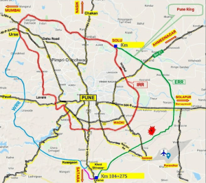
The project actually consists of two ring corridors:
| Road Type | Length | Authority | Purpose |
|---|---|---|---|
| Inner Ring Road | ~83 km | Pune Metropolitan Region Development Authority | City traffic distribution |
| Outer Ring Road | ~173 km | Maharashtra State Road Development Corporation | Regional bypass |
The ring road concept was first proposed decades ago when planners anticipated Pune’s rapid expansion beyond municipal limits. However, several factors delayed progress:
- Land acquisition resistance from villages
- Environmental clearance challenges
- Funding model revisions
- Alignment redesigns to reduce displacement
Between 2016 and 2024, the project underwent multiple revisions, particularly in western Pune, where terrain and real estate density complicated alignment. The final plan divides construction into phased packages so segments can be built simultaneously.
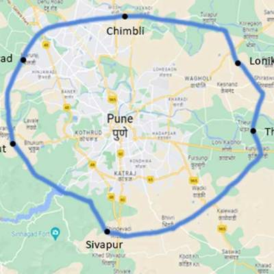
Route Alignment & Regional Connectivity
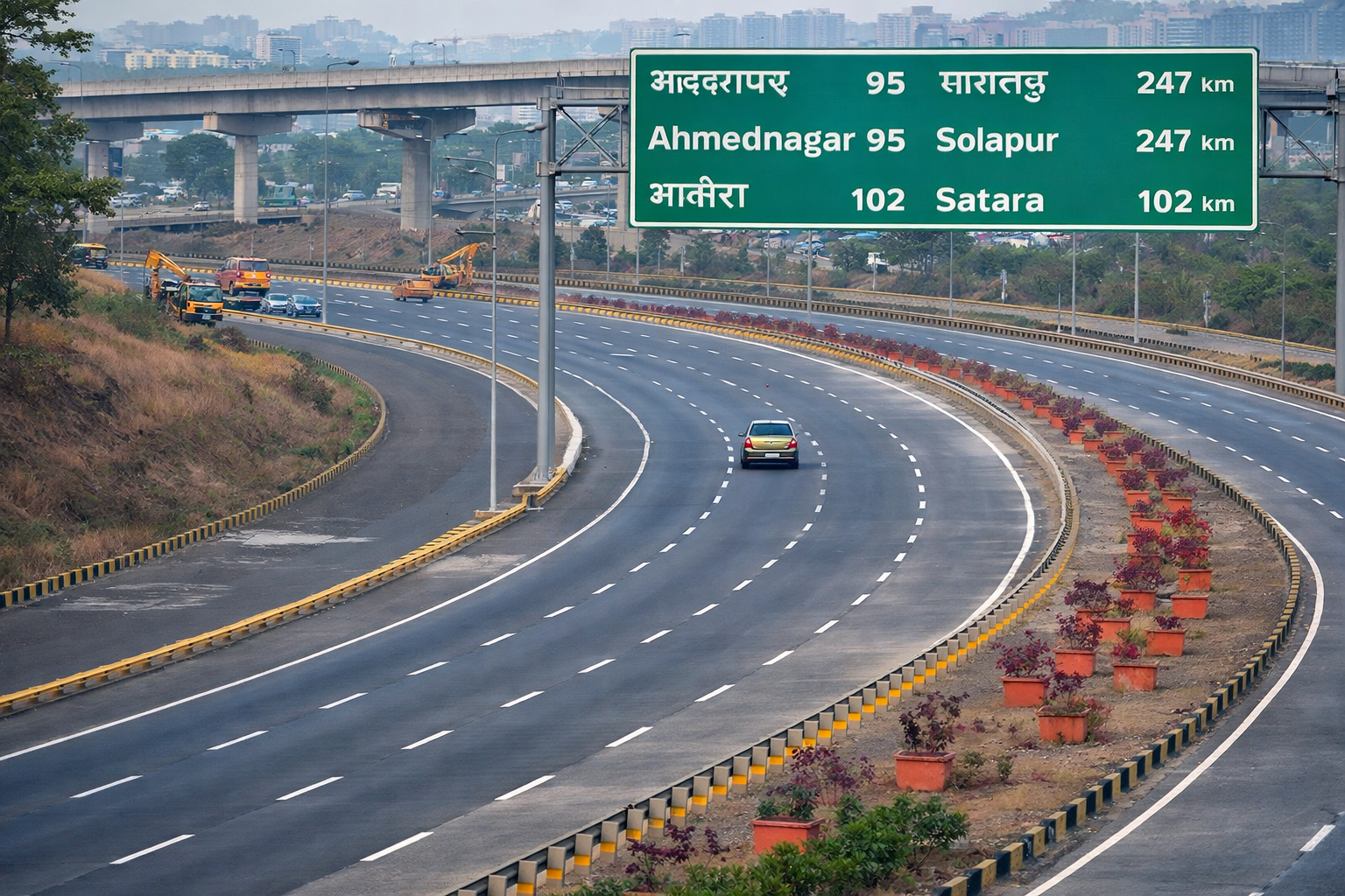
The outer ring road is planned as a controlled-access express corridor encircling the city’s outskirts. It will connect major national highways radiating from Pune toward:
- Mumbai
- Nashik
- Ahmednagar
- Solapur
- Satara
Districts & Talukas Covered
The alignment passes through nine talukas, including:
- Haveli
- Mulshi
- Bhor
- Khed
- Shirur
- Purandar
- Daund
This positioning ensures trucks and long-distance vehicles can bypass city roads entirely.
Engineering Design Specifications
Technical highlights
- Six-lane access-controlled carriageway
- Design speed: ~120 km/h
- Service roads on both sides in populated zones
- Grade-separated interchanges
- Wildlife crossings in select areas
- Stormwater drainage corridors
Structures Planned
| Structure Type | Approx. Count |
|---|---|
| Major interchanges | 14 |
| Railway overbridges | 3 |
| Vehicular overpasses | 25+ |
| Underpasses | 100+ |
| Culverts | 200+ |
These features are intended to create a signal-free circular expressway.
Cost, Funding & Implementation Model
The estimated cost ranges between ₹15,000 crore and ₹18,000 crore, depending on land compensation and inflation adjustments.
Funding structure
- A hybrid model combining government funding and private investment
- Likely toll-based recovery for private concessionaires
- Phased tendering for construction packages
Land acquisition alone accounts for a major portion of the project cost.
Land Acquisition & Compensation
Land acquisition is the most complex phase of the project.
Key facts:
- Thousands of hectares are required across multiple villages
- Compensation based on market-linked formulas
- Several alignments were modified to reduce displacement
In some segments, compensation payments already exceed ₹2,500 crore. Authorities also implemented:
- direct bank transfers
- arbitration panels for disputes
- realignment where litigation risk was high
Environmental & Social Considerations
Large infrastructure projects must balance growth with sustainability. The ring road includes mitigation measures:
Environmental safeguards
- tree plantation drives along the corridor
- wildlife movement corridors
- rainwater harvesting systems
Social mitigation
- relocation packages for affected households
- livelihood compensation for farmers
- access roads for villages divided by the highway
Economic Impact Forecast
Urban planners expect the project to reshape Pune’s development geography.
1. Logistics & Industry Boost
Industrial clusters around the outskirts will gain faster highway access, reducing transport time and costs.
2. Real Estate Growth Corridors
Peripheral areas near interchanges typically see:
- land value appreciation
- new residential townships
- commercial hubs
3. Reduced Urban Congestion
Heavy vehicles currently entering the city can instead bypass it, improving traffic flow and air quality.
Comparison with Other Indian Ring Roads
| City | Project | Length | Impact |
|---|---|---|---|
| Hyderabad | Outer Ring Road | 158 km | Transformed logistics & IT growth |
| Bangalore | Peripheral Ring Road | Planned | Expected to ease congestion |
| Pune | Outer Ring Road | ~173 km | Still under phased execution |
Observation: Cities that completed ring roads earlier saw major suburban expansion and infrastructure-driven economic growth.
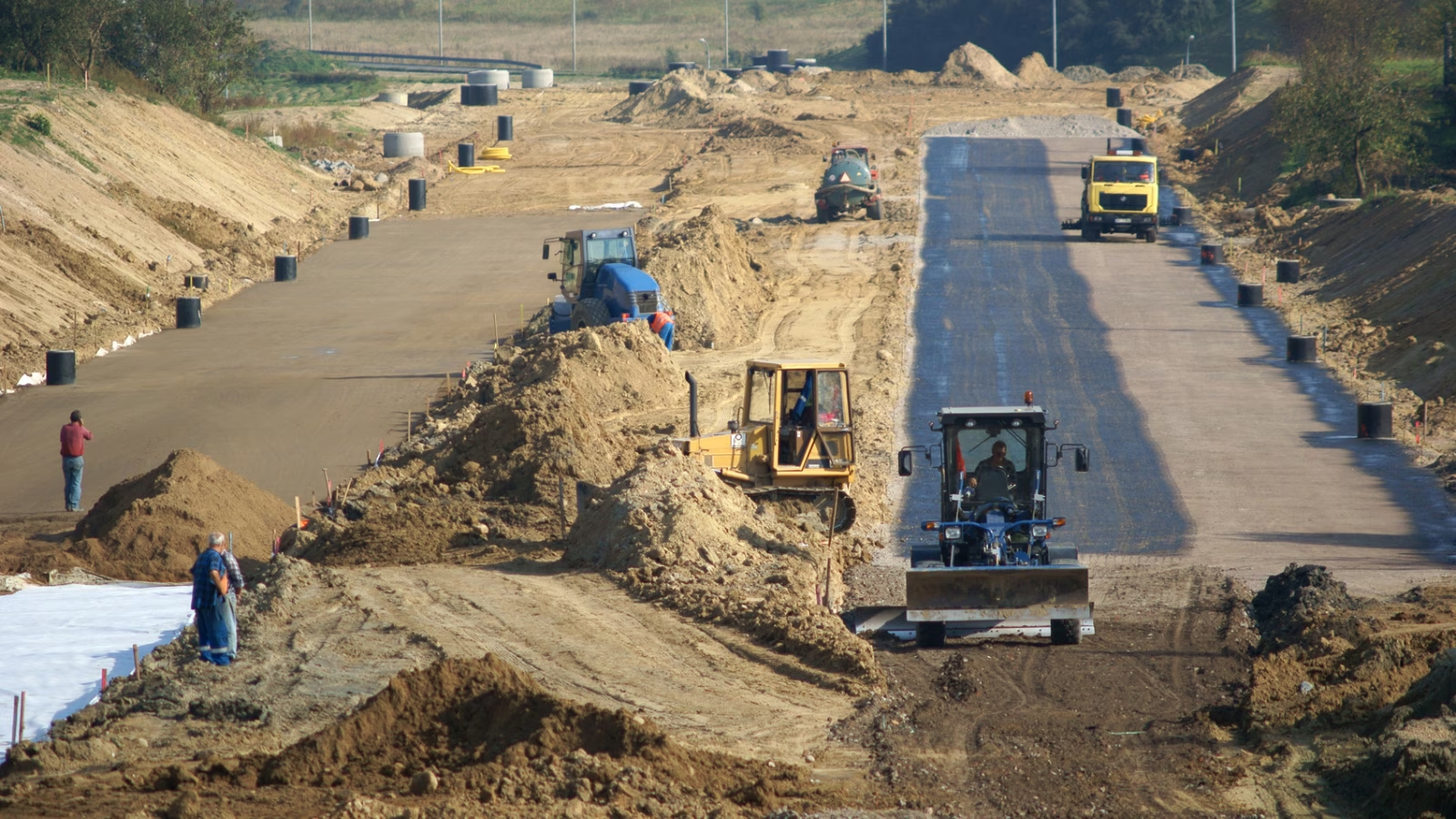
Construction Timeline & Expected Completion
Because of phased execution, different sections will finish at different times.
Projected milestones (subject to change)
| Phase | Status |
|---|---|
| Land acquisition | Ongoing in some segments |
| Tendering | Completed for select packages |
| Construction | Starting in western stretch |
| Full completion | Likely late-decade (approx. 2027–2030 range) |
Large infrastructure projects of this scale commonly experience timeline adjustments.
Strategic Importance for Pune’s Future
Urban experts consider the ring road essential because Pune is transitioning from a single-core city to a multi-node metropolitan region. Without a bypass corridor, growing traffic from logistics, industry, and commuters could overwhelm city roads.
The project supports:
- smart city expansion
- regional satellite town development
- airport connectivity
- freight efficiency
Final Analysis
The Pune Ring Road is not merely a highway — it’s a long-term regional growth framework. While delays and land issues remain real challenges, steady progress indicates the project is moving from planning to execution.
Once completed, it is expected to:
✔ cut cross-city travel time drastically
✔ Reduce congestion inside Pune
✔ reshape real estate patterns
✔ strengthen regional trade networks
In summary, the ring road could serve as the fundamental infrastructure that supports Pune’s growth over the next two decades.
Phase-Wise Route Map Breakdown (Pune Outer Ring Road)
Phase 1 – North-East & Eastern Loop
Route:
Theur Phata → Kesnand → Wagholi → Charholi → Bhavdi → Tulapur → Alandi → Kelgaon Chimbli → NH 50
- Starts at Theur Phata — on Pune–Satara highway (NH 9)
- Moves eastward through rapidly developing suburbs like Kesnand and Wagholi
- Passes Charholi and Bhavdi (important residential/industrial cluster areas)
- Moves north to Alandi, then northeast to Kelgaon Chimbli
- Connects to NH 50 near Narhe and Chimbli area
- This forms the northern and eastern part of the ring alignment.
Approx Length: ~40–50 km
Major feature: Links NH-9 (Satara Road) with NH-50 (Pune–Ahmednagar Road)
Phase 2 – North & North-West Stretch
Route:
📍 NH 50 (Chimbli) → Nighoje → Sangurde → Shelarwadi → Chandkhed → Pachne → Pimploli → Rihe → Ghotawde → Pirangut
- Begins from the NH 50 junction at Chimbli
- Continues northwest through Nighoje, Sangurde, and the rural belt
- Connects smaller villages like Shelarwadi, Chandkhed, Pachne, Pimploli, Rihe, and Ghotawde
- Ends near Pirangut Phata (on NH-48 corridor)
- This segment closes the north and northwest ring loop.
Approx Length: ~40–50 km
Major feature: Provides connectivity with NH-48 (Mumbai–Pune–Bengaluru corridor)
Phase 3 – West & South-West Section
Route:
📍 Pirangut → Bhugaon → Chandni Chowk → Ambegaon → Katraj
- Starts from Pirangut Phata on the western edge
- Moves southward through Bhugaon
- Passes Chandni Chowk and Ambegaon
- Ends at Katraj — a key suburb on the Pune–Satara highway
- This phase completes the western downlink of the ring.
Approx Length: ~20–25 km
Major feature: Links NH-48 area with NH-9 corridor near Katraj
Phase 4 – South & South-East Closure Loop
Route:
📍 Katraj → Mangdewadi → Wadachiwadi → Holkarwadi → Wadkinaka → Ramdara → Theur Phata → NH 9
- Begins at Katraj (south of Pune)
- Moves eastward through Mangdewadi, Wadachiwadi, Holkarwadi, Wadkinaka
- Reaches Ramdara
- Reconnects back to Theur Phata (completing the ring)
- Join the NH 9 (Pune–Satara Road) to close the loop.
Approx Length: ~30–45 km
Major feature: Connects the southern alignment back to eastern starting point, forming a complete circular corridor
How the Full Ring Forms
You can visualize the full route as a large clock around Pune:
✔ Phase 1: Eastern flank
✔ Phase 2: North & northwest curve
✔ Phase 3: Western to southwest
✔ Phase 4: Southern to southeast closure
This forms the ~173 km controlled access ring around Pune.
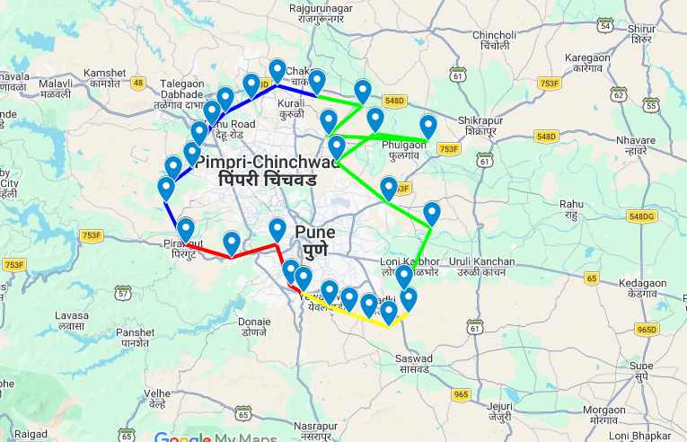
Color Legend
- Phase 1 → Green
- Phase 2 → Red
- Phase 3 → Blue
- Phase 4 → Yellow